
Flyableday
Do you know where you’re flying tomorrow?
Thermals, wind and over 5000 rated launch sites. Calculated from German Weather Service data. Free.
Flyableday
Thermals, wind and over 5000 rated launch sites. Calculated from German Weather Service data. Free.
Thermal map
Usable working height, climb, cloud base, wind at every altitude, thunderstorm risk and rain. Every layer sorted by the question it answers. One slider, and you watch the whole day go by.
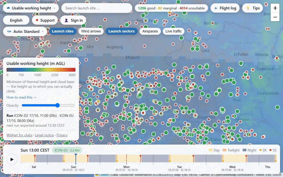
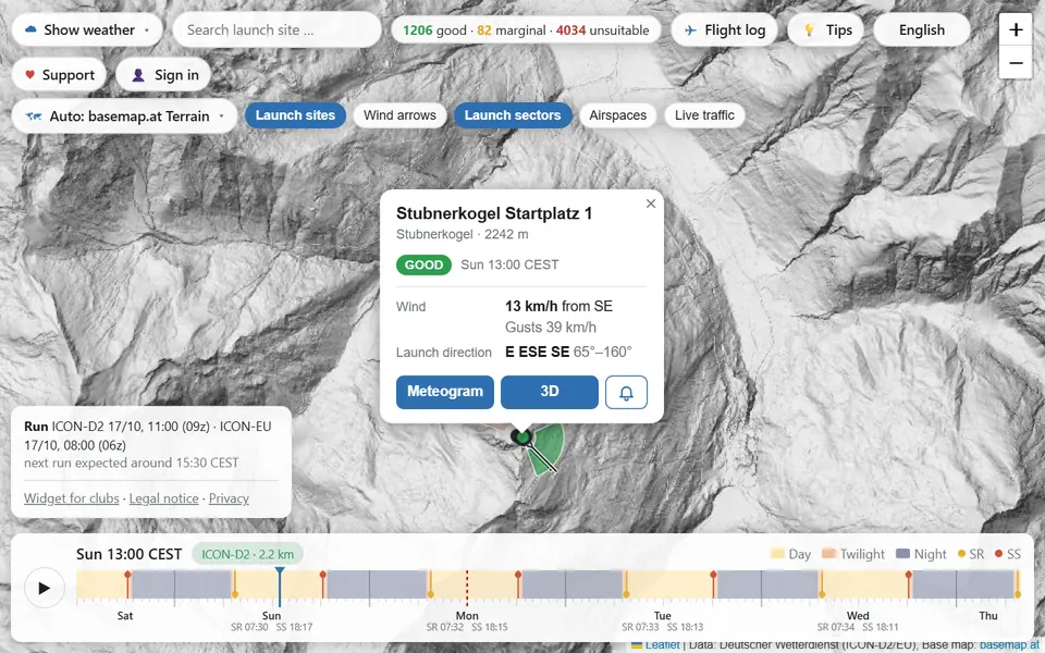
Launch sites
Every launch site is rated for the selected hour: does the wind direction fit the launch sector, do wind and gusts stay within limits? The fan on the marker shows why a site works or not.
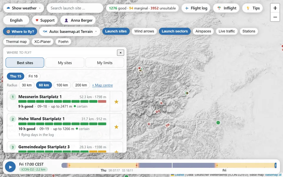
Where to fly?
One button, and you get the best launch sites near you for today, tomorrow or the day after. With the good hours, working height and an honest note on how certain the forecast is.
Ranking within 30 to 200 km. Your favourite sites as a week at a glance, with an arrow when something has changed since the last run.
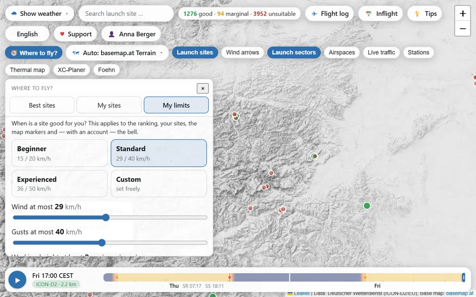
Beginner, standard, experienced or your own values for wind, gusts and minimum height. The traffic lights on the map follow them.
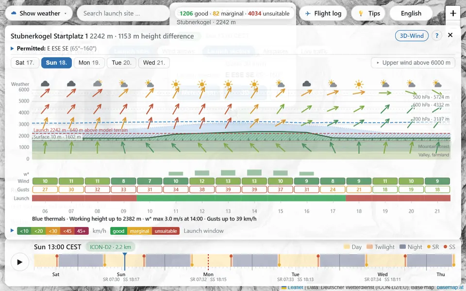
Meteogram
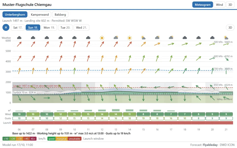
Wind at all altitudes, thermals, cloud base, cumulus or blue thermals, rain and thunderstorms for exactly this spot. The launch window shows when it works. Next to it, what the nearest weather station is measuring right now.
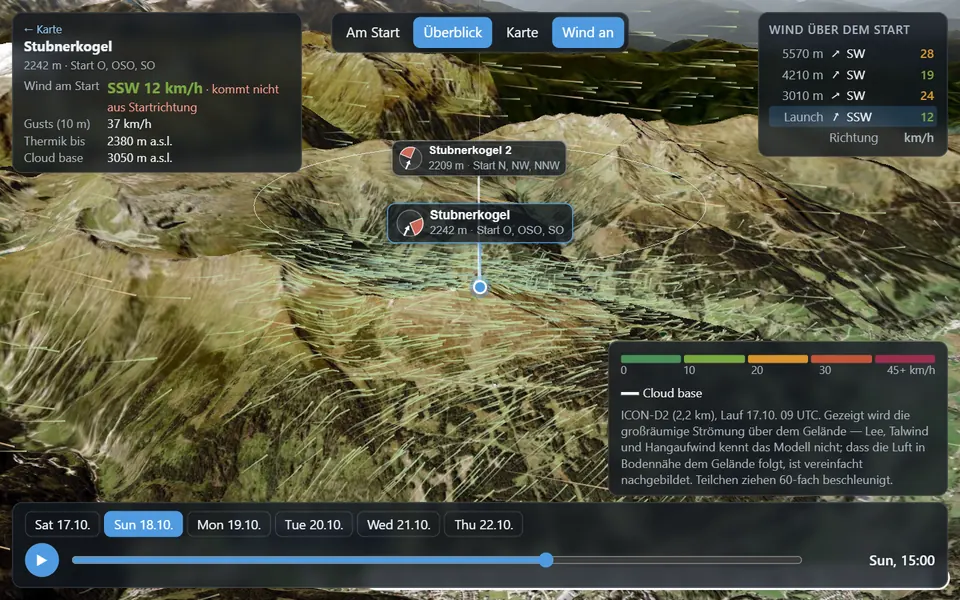
3D wind
Real terrain, aerial imagery and the forecast wind as drifting particles. Turn around, climb up to 2000 m above launch and play the day in time-lapse.
And much more
What is actually in the air right now, from the Open Glider Network. Where a sailplane is circling, the thermals are working.
Pressure difference across the Alps: twelve hours measured, plus the forecast for up to three days.
Official boundaries with an altitude filter and the question: am I allowed in there?
Wind and gusts from stations in ten networks, updated continuously.
Click a route, close the triangle, see the height needed at every turnpoint.
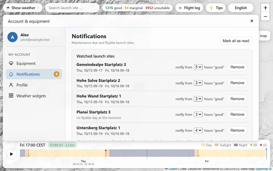
A message as soon as a flying day is coming at your sites. And when it falls apart again.
Good flying windows right in your calendar, updated after every run.
Nearby thunderstorms and reachable landing fields while you fly.
Weekly calendar and meteograms of your sites for when you have no signal.
Direction and strength from the ground up to 5500 m, on top of any layer if you like.
German, English, French, Italian, Czech, Slovak, Hungarian.
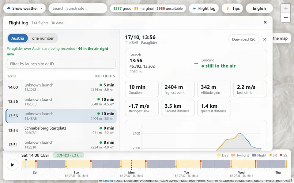
Flight log
Every paraglider the Open Glider Network hears over Austria ends up in the flight log with track, altitude band and key figures. Enter your tracker ID and you have your own logbook without pressing a button.
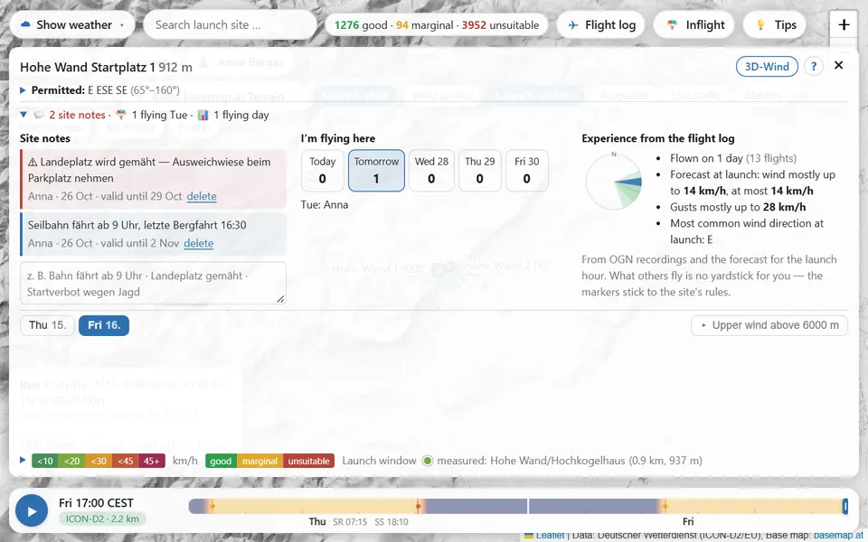
Together
“Lift runs from 9”, “landing field mowed”: short notes with an expiry date. And whoever is on the same mountain tomorrow finds a shared ride and a retrieve driver.
Wing, reserve and harness with service intervals. Around a hundred models in the catalogue, and the reminder arrives in time.
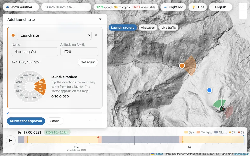
Set a point, choose the launch directions, done. From then on it is rated like all the others.
A widget with the forecast for your sites, simply embedded in your own website. How it works (in German)
Tips & know-how
Short articles on thermals, wind, thunderstorms, airspace and planning a flying day, and how to use the map for it.